
In different regions of the planet, there are climatic phenomena that surprise due to their violence and speed. Among them is the “downburst,” also known as a descending gust, rain bomb, or hammer blow. Its destructive capacity often leads to confusion with a tornado, although its nature and dynamics are different.
While in tornadoes the air spirals towards a center and ascends with great intensity, in downbursts the opposite occurs: a mass of air descends abruptly and disperses in all directions upon reaching the surface. This straight-line movement gives it unique and dangerous characteristics.
Downbursts can develop in a matter of seconds and reach wind speeds exceeding 200 km/h. Their force is sufficient to topple trees, rip off roofs, and affect infrastructures, especially in rural or coastal areas with less protection against extreme weather phenomena.
Despite their brevity, their impact is profound. They may last just minutes, but they leave behind a scene of destruction that makes them a challenge for the prevention and resilience of communities exposed to intense storms.
A phenomenon with multiple variations
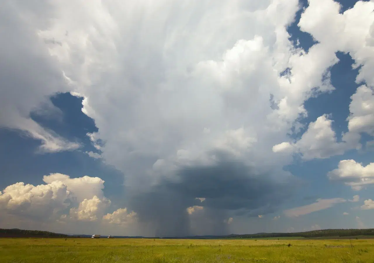
The downburst originates within clouds of great vertical development, such as cumulonimbus clouds, which concentrate large amounts of moisture and energy. Its classification depends on how it manifests on the surface and on the interaction of rain with the air.
One of the most well-known types is the dry downburst. In this case, the precipitation falling from the cloud evaporates before reaching the ground, cooling the air and making it denser. This air descends rapidly, generating violent wind gusts that, paradoxically, are not accompanied by rain on the surface.
The wet downburst, on the other hand, discharges precipitation directly onto the ground. The force of the descending air drags along intense rain, hail, or snow, which upon impact generate a front of horizontal wind that is difficult to predict. These events are especially dangerous for boats and aircraft, which can lose stability in a matter of seconds.
Both types of downbursts share the same origin: the interaction between cooling of the air and the weight of water or ice particles inside the cloud. Studying them is key to understanding how the atmosphere releases energy and how these events are related to climate change and the increasing frequency of intense storms.
 The “downburst” is a climatic phenomenon often confused with a tornado. Photo: ECOticias.
Necessary conditions for a downburst to occur
Downbursts require a very specific meteorological scenario. First, they form in unstable environments, where masses of warm and humid air ascend easily, giving rise to clouds of great vertical development.
In those clouds, cooling of the air by evaporation or sublimation is crucial. When rain or hail falls and partially evaporates in dry layers of the atmosphere, the air cools and becomes denser, accelerating its descent to the ground.
Another essential factor is the accumulation of water or ice inside the cloud. The weight of these particles reinforces the downward current, generating a collapse that, upon reaching the surface, expands horizontally in all directions. The presence of strong convective currents, contrasting temperatures, and abundant humidity increase the likelihood of their formation.
These elements explain why downbursts are more common in warm and humid climates, such as those in tropical or subtropical regions, although they are also recorded in semi-arid areas when dry air masses combine with summer storms.