
After the severe floods that affected Bahía Blanca, the government of the City of Buenos Aires has developed an interactive 3D map that allows identifying areas prone to environmental risks, especially hydrological risk.
This tool provides a detailed insight into the possibility of extreme water-related events such as floods, droughts, and landslides, enabling a more effective management of infrastructure and water in the city.
How does the interactive map work?
Unlike traditional maps, this platform allows exploring the city from a three-dimensional perspective, increasing the accuracy in identifying vulnerable areas. To access the map, users must go to ciudad3d.buenosaires.gob.ar and follow these steps:
- Select the layer “Lots with impacts”.
- Choose from the dropdown menu “Hydrological Risk”.
- Use the search engine to enter a specific address and evaluate the hydrological risk of a particular property.
This innovation allows a detailed visualization of areas affected by possible river flooding, facilitating decision-making regarding infrastructure and prevention.
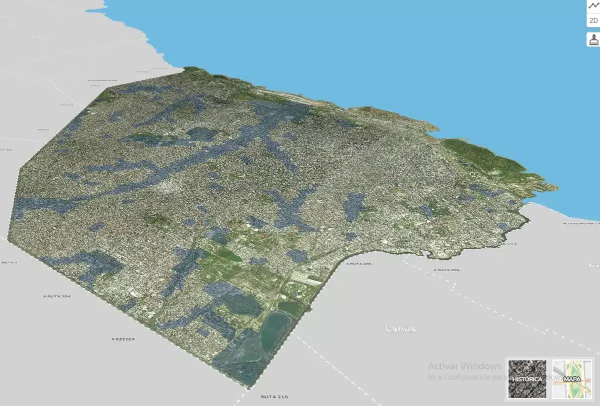 This is how the map that helps predict the risk of floods in the city looks like
Areas with higher hydrological risk
The map highlights some of the areas most exposed to hydrological events in Buenos Aires, mainly concentrated in areas near stream basins and their surroundings:
- Maldonado Basin: Crosses the city from west to northeast, following Juan B. Justo Avenue. There is a high risk of flooding in neighborhoods like Las Cañitas and Bosques de Palermo.
- Villa Lugano and Villa Soldati: Both areas are located on the Cildañez stream basin, making them highly vulnerable to hydrological events.
- Parque Chas, Belgrano, and Villa Ortúzar: They also present elevated risks due to their proximity to the Vega stream basin, another critical point in the city.
Importance of prevention and risk management
The development of this map not only allows knowing the risk areas but also encourages preventive planning against possible natural disasters. Water management, the design of more resilient infrastructures, and raising awareness about hydrological risks are key to reducing the impact of future floods.
This tool represents a significant advancement in how the city faces climate change and environmental security, providing key information for decision-making at both governmental and citizen levels.
Have you already visited our YouTube channel? Subscribe!