
International scientists, led by the **British Antarctic Survey (BAS)**, have created the most detailed map to date of the landscape lying beneath the [Antarctic ice sheet](https://noticiasambientales.com/medio-ambiente/deshielo-record-en-la-antartida-un-escenario-que-preocupa/).
This ambitious project, known as **Bedmap3**, is based on more than **six decades of collected data** through planes, satellites, ships, and even dog sleds. The results of this research have been recently published in the journal *Scientific Data*.
## A view of the ice-free white continent
The map offers an unprecedented perspective of the **Antarctic continent** as if its 27 million cubic kilometers of ice had been removed. This **volume of ice** is so colossal that if it were to melt completely, it would raise sea levels by 58 meters.
The average thickness of the ice sheet is approximately two kilometers, while the deepest point reaches 4,757 meters, located in a canyon in the **Wilkes Land**, according to recent data revising previous findings.
## Advancements in terrain knowledge
Bedmap3 has allowed filling significant gaps in the understanding of the Antarctic landscape, especially in critical areas such as the **South Pole**, the **Antarctic Peninsula**, the coasts of **West Antarctica**, and the **Transantarctic Mountains**. The map also details deep valleys and places where rocky mountains emerge from the ice, thanks to advanced techniques such as radar, seismic reflection, and gravitational measurements.
Additionally, the **satellite data** has provided greater precision in the height and shape of the ice sheet, as well as the thickness of [floating ice shelves](https://noticiasambientales.com/medio-ambiente/un-tsunami-de-hielo-impacto-en-siberia-que-es-y-como-se-forma/). It has also detailed the grounding lines, the points where land ice meets the **ocean** and begins to float.
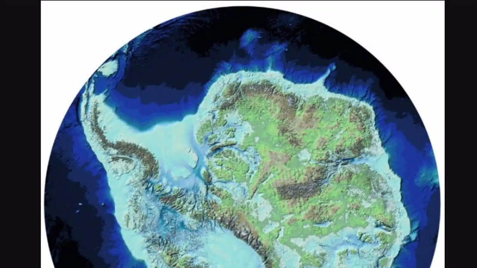 What Antarctica looks like without ice (EuropaPress)[/caption>
## Implications and vulnerabilities
**Peter Fretwell**, a mapping specialist at BAS, emphasizes that the Antarctic ice sheet is thicker than previously thought and contains a larger volume of ice settled on **rocky beds below sea level**. This increases the risk of melting caused by the entry of warm ocean water at the continent’s margins.
“What Bedmap3 shows us is that we have a slightly more vulnerable Antarctica than we imagined,” warns Fretwell as highlighted by EuropaPress.
The detailed knowledge of the **Antarctic terrain** is not only fascinating from a scientific point of view but also crucial to understand how this region could evolve in the face of **climate change**. This map represents an important step towards assessing the risks associated with ice melting and the consequent **sea level rise**.
*Cover photo: Cassie Matias*
Have you visited our YouTube channel yet? Subscribe!