
The Water Authority (ADA) approved the hydrological hazard map for the basin of the San Francisco, Las Piedras, Sarandí, and Santo Domingo streams, delineating critical areas and establishing restrictions for works and constructions. The aim is to organize land use and reduce risks in suburban districts that often suffer overflows when water levels rise.
The map prohibits the creation of obstacles —such as works or plantations— without prior authorization from the ADA, and restricts hydraulic feasibility for new constructions in risk areas.
Simulation and Results
The study was based on a rain simulation similar to the one that occurred during the tragic 2013 La Plata flood, identifying:
- Maximum flood levels.
- Dynamic floodability.
- Water retention times.
- Most affected areas.
The results showed that Quilmes Oeste is the most compromised region, especially in former wetlands precariously urbanized. Over 300,000 residents live there along the streams.
Affected Municipalities
The basin impacts:
- Avellaneda
- Quilmes
- Lanús
- Lomas de Zamora
- Florencio Varela
- Almirante Brown
The most hazardous points are concentrated on streets that drain into the Las Piedras stream, in San Francisco Solano and Villa La Florida.
Critical Data
According to ADA:
- Water retention times with heights exceeding 0.30 meters are prolonged.
- Floodability values exceed 1.50 meters, causing significant damage.
- Risk management plans and contingency actions are required to intervene in the most compromised areas.
Obligations for Municipalities
The resolution published in the Official Gazette obliges the municipalities to incorporate the map information into their Territorial and Building Codes, establishing restrictions on land use and constructions in risk areas.
The map will allow:
- Identifying areas susceptible to flooding.
- Quantifying the potential magnitude of events.
- Serving as a basis for territorial planning.
- Implementing mitigation measures.
- Developing risk management plans.
Information for the Population
In addition to guiding authorities, the map aims to inform citizens about the potential flood danger and facilitate prevention and mitigation measures.
Watershed Committee and Priority Works
In April 2024, the Buenos Aires Legislature created the San Francisco-Las Piedras Streams Watershed Committee, promoted by then-mayors Mayra Mendoza (Quilmes), Mariano Cascallares (Almirante Brown), and Andrés Watson (Florencio Varela).
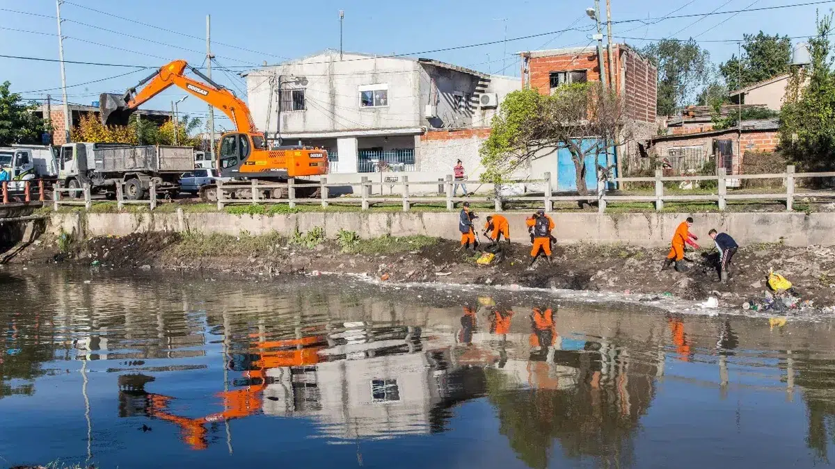
In November, Mendoza reaffirmed the “historical debt with the Quilmes community and neighboring municipalities” and requested funding to execute the maintenance and cleaning plan for the basin.
Governor Axel Kicillof and Infrastructure Minister Gabriel Katopodis designed a plan with 15 key works for the next two years. One of the most prioritized is the construction of storm drains in the San Francisco-Las Piedras basin, which will impact Bernal Oeste.
The proposal includes:
- Construction of a concrete channel.
- Reinforcement and stabilization of slopes.
- Retaining walls on both banks.
- Comprehensive cleaning of the channel, with removal of sediments, waste, and obstructive vegetation.
The hydrological hazard map and the projected works aim to transform risk management in the Buenos Aires suburbs. The combination of territorial planning, infrastructure, and community participation will be key to reducing the impact of floods and ensuring greater safety for thousands of residents.