
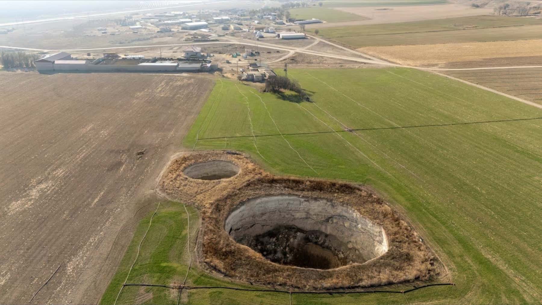
In the Turkish province of Konya, the ground is giving way with a frequency that is no longer perceived as an isolated event, but as a structural symptom. In the agricultural region of Karapınar, sinkholes have proliferated, appearing suddenly in fields of corn, wheat, and sugar beet.
According to a count cited by Reuters, nearly 700 sinkholes have been recorded, with no victims so far, but with a real risk due to their unpredictable nature.
What a sinkhole is and how it forms
A sinkhole is a depression or collapse of the ground that occurs when underground cavities are emptied or weakened and the upper material loses support. In areas with soluble rocks, such as karst landscapes, these cavities can form naturally over centuries.
What accelerates the process is the sudden change in the subsurface balance, especially when the water that previously acted as support by pressure decreases. The withdrawal of groundwater, whether for supply or irrigation, can favor new collapses if it reduces the aquifer level.
The core of the problem in Konya
The Konya region is one of Turkey’s granaries, dependent on irrigation to maintain high yields in an increasingly dry environment.
According to Professor Fetullah Arik from the Konya Technical University, the combination of drought and intensive groundwater extraction has accelerated the drop in the water table: from descending half a meter annually in the previous decade, it now does so at a rate of 4 to 5 meters per year.
Illegal wells and pressure on the aquifer
The vicious circle worsens with the lack of regulation. In Karapınar, it is estimated that there are 120,000 unauthorized wells compared to 40,000 legal ones. This pressure on the aquifer increases when it rains less and irrigation becomes the only salvation for the crops.
The visible consequence is that, where the subsurface loses cohesion, the field can open up in a matter of seconds, sometimes with a roar, a few meters from those working the land. Local farmers have recounted recent episodes reflecting the growing concern in the area.
Institutional and scientific response
The Turkish public agency AFAD (Disaster and Emergency Management Authority) has begun working on the identification of sensitive areas, developing a sinkhole susceptibility map and an associated action plan.
In parallel, the scientific community now has advanced tools, such as local geophysical campaigns and satellite observation. Missions like NASA’s GRACE have allowed the measurement of changes in groundwater from variations in the gravitational field, useful for monitoring the evolution of large regions.
A problem beyond geology
The debate is no longer just geological. It is agricultural, economic, and political. Reducing the risk involves unglamorous but decisive decisions:
- Controlling water withdrawals.
- Improving irrigation efficiency.
- Adjusting crops to the real water balance.
- Strengthening institutional oversight.
Without this shift, the landscape of Konya risks normalizing the abnormal, becoming a board of holes where each agricultural campaign is played with a new factor of uncertainty.
The sinkholes of Konya are a reminder of how the overexploitation of natural resources can transform a geological phenomenon into an agricultural and social crisis. Water management and well regulation are key to preventing this region, vital for Turkey’s food security, from becoming a land marked by fragility and uncertainty.