
La Fundación Vida Silvestre Argentina participated in the launch of the Collection 2 of MapBiomas Argentina, an initiative that collects and analyzes satellite data on land cover and land use between 1985 and 2024, including native forests.
This tool allows visualization of how Argentine territory has transformed over the last four decades, providing key scientific evidence for territorial planning and biodiversity conservation.
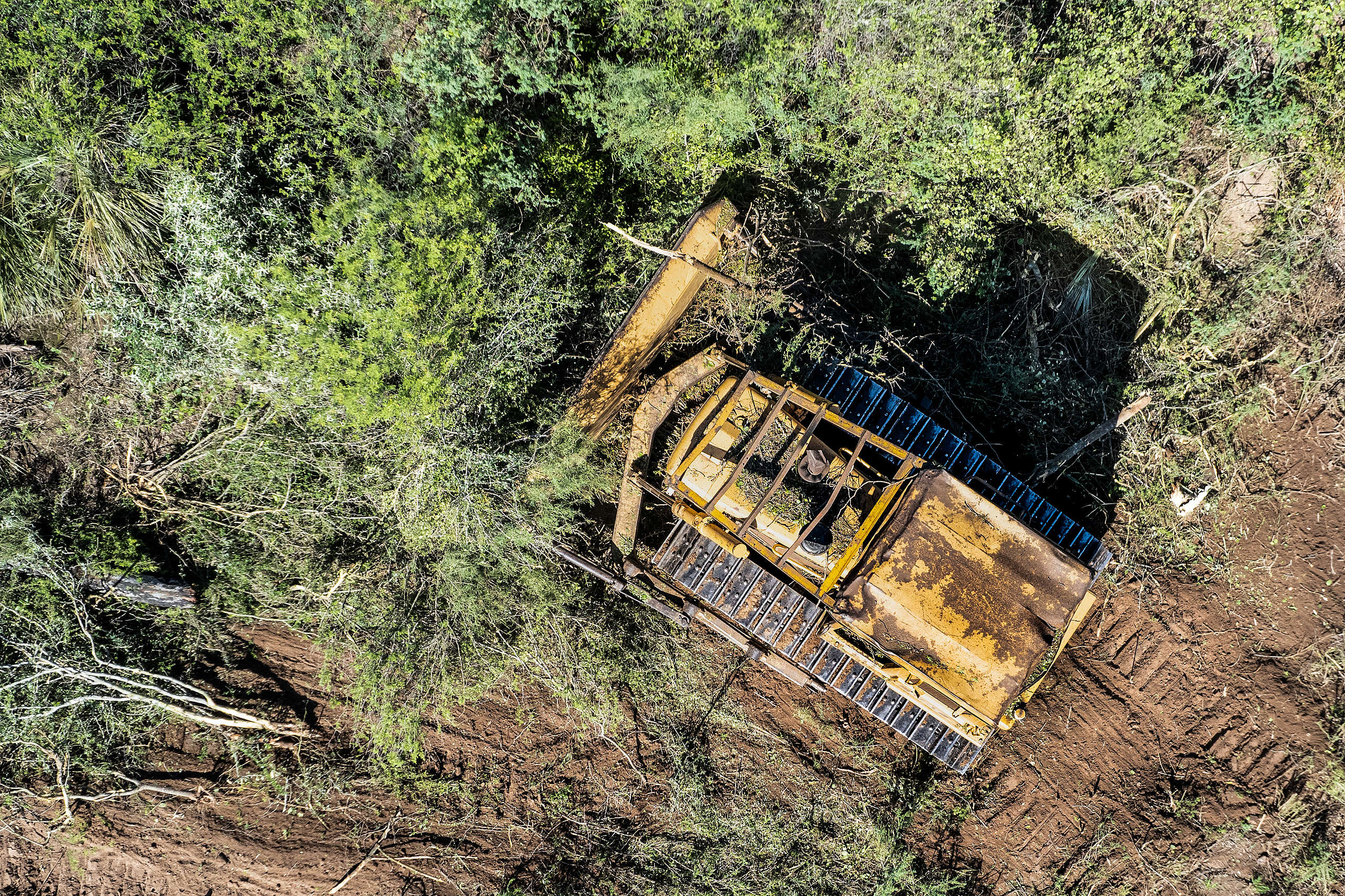
Loss of Native Forests: A National Alert
Argentina lost 18% of its forest area since 1985, equivalent to three times the province of Misiones.
According to the analysis, the country lost 10.5 million hectares of forests, of which 89% corresponds to closed forests, the densest and most biodiverse. Although 46.5 million hectares are still preserved, pressures on these ecosystems continue to advance.
This loss represents not only an environmental impact but also a direct impact on essential ecosystem services, such as climate regulation, water and food provision, and the protection of species.
“The loss of forests affects human life and that of countless species,” stated Sebastián Fermani, conservation director of Fundación Vida Silvestre Argentina.
Agriculture and Urbanization: The Engines of Change
Agriculture grew by 46%, while urban areas increased by 35% across the country.
During the same period, agriculture expanded by 11.9 million hectares, consolidating as the dominant anthropic use. In parallel, natural herbaceous and shrub vegetation decreased by 2.4 million hectares.
Urbanization also showed significant growth, especially in the Pampas and Patagonia, and in medium-sized cities and the Greater Buenos Aires Agglomeration, which grew by over 37%.
Ecoregions Under Pressure: A Detailed Analysis
The Chaco region concentrates 78% of the country’s total forest loss.
- Chaco Region: lost 8 million hectares, 21% of its forest cover
- Espinal: lost 11% nationally, with a 32% increase in temporary crops
- Paranaense Forest: lost 15.6%, with a strong presence of forestry and perennial crops
- Yungas: lost 8%, with a 111% increase in temporary crops
- Andean Patagonian Forest: lost 6%, while urban areas grew by 37%
- Pampas: already transformed by 50% in 1985, grew by 2.4 million hectares more
MapBiomas: Open Science for Sustainable Decisions
A key tool for monitoring the territory and designing evidence-based public policies
“Having historical and updated data is key to understanding how we are transforming our territory,” concluded Ana Eljall, coordinator of MapBiomas Argentina.
The initiative offers open access to geospatial information, facilitating the work of researchers, public managers, and local communities. Its goal is to strengthen decision-making, promote sustainable territorial development, and protect the most vulnerable ecosystems in the country.
Source: Fundación Vida Silvestre