
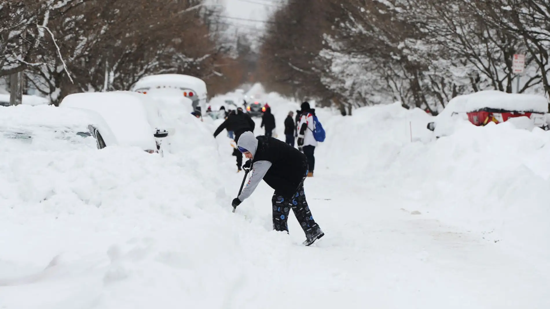
More than 500,000 people in central New York state received an official warning to avoid non-essential travel. The measure was in response to a snowstorm that particularly affected Syracuse and its surroundings.
The phenomenon, identified as lake-effect snow by the National Weather Service, generated accumulations exceeding 20 centimeters. The conditions complicated mobility and increased the risk on roads.
The warning, issued from the Binghamton office, remained active until 6:00 PM, with a possibility of extension. Additionally, monitoring included reports from Buffalo due to snowfalls in the western part of the state.
The Onondaga County recorded the highest snow levels. Meanwhile, the 511 system provided updated information on roads and closures.
Impact on daily life and state response
The storm disrupted the routine in the Syracuse metropolitan area, where about 150,000 people live. Therefore, authorities recommended teleworking and suspension of non-essential activities.
Governor Kathy Hochul expanded the state of emergency to expedite resources. More than 2,000 workers and 660 pieces of snow removal equipment were deployed.
Additionally, emergency centers and cleaning operations were activated on priority roads. Authorities asked to avoid parking on main streets to facilitate tasks.
Public transportation and intercity traffic experienced delays. The combination of snow and wind increased the risk of accidents.
What is lake-effect snow and why does it intensify?
Lake-effect snow occurs when cold air moves over relatively warm waters, such as the Great Lakes. By absorbing moisture, the air generates intense precipitation when returning to land.
According to the National Oceanic and Atmospheric Administration, this process can concentrate in narrow bands. Therefore, nearby areas show notable differences in accumulation.
In regions like the Finger Lakes, there were reports of rapid increases in snow thickness. Meanwhile, other areas remained partially clear.
This type of event is part of the winter systems of the northeastern United States. However, its intensity can vary depending on the water temperature and air masses.

The polar wave in the United States and its climatic context
The storm in New York is part of a sequence of extreme events during the winter of 2026. Various cities in the northeast recorded record accumulations and unusually low temperatures.
The polar wave impacted energy consumption and transportation infrastructure. It also required reinforcing emergency protocols in several states.
These episodes highlight the vulnerability of urban areas to intense climatic phenomena. Therefore, experts emphasize the importance of adaptation plans.
Community preparedness and real-time information are key to reducing risks. Meanwhile, meteorological monitoring continues until conditions stabilize.